I specialize in providing high-quality drone services for agriculture and environmental applications. With a strong background in agricultural science and years of hands-on experience in UAV-based remote sensing, I help farmers, researchers, and land managers capture the insights they need to make better decisions.
I hold a Remote Pilot License (RePL, <25kg) and have flown a wide range of drones and sensors, from multispectral UAVs for crop monitoring to RGB imaging for mapping and surveying. My work has spanned wheat, cotton, sorghum, and pasture systems, as well as environmental monitoring projects.
What sets me apart is my blend of research expertise and practical field experience. I understand what data matters most, whether it’s crop health indices, biomass estimation, trial documentation, or land-use mapping, and I deliver results that are clear, accurate, and ready to use.
Based in Brisbane, available across South-East Queensland and beyond (weekend availability).
Services include:
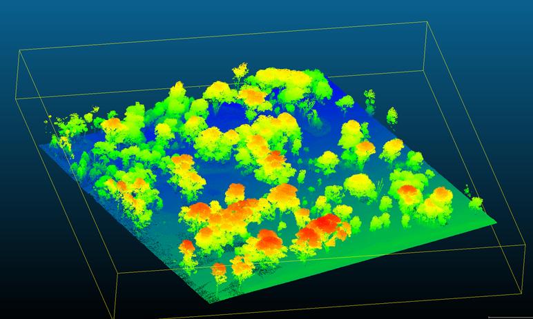
Aerial mapping & orthomosaics (RGB & multispectral)
Crop health & vegetation indices (NDVI, NDRE, OSAVI, etc.)
Stand counts, biomass & canopy cover estimation
Trial documentation and precision agriculture support
Environmental and land-use surveys
If you need reliable, science-backed drone services to support your farm or research project, get in touch, I’d be glad to help.