2 min compilation video showing aerial videography, inspection & survey examples
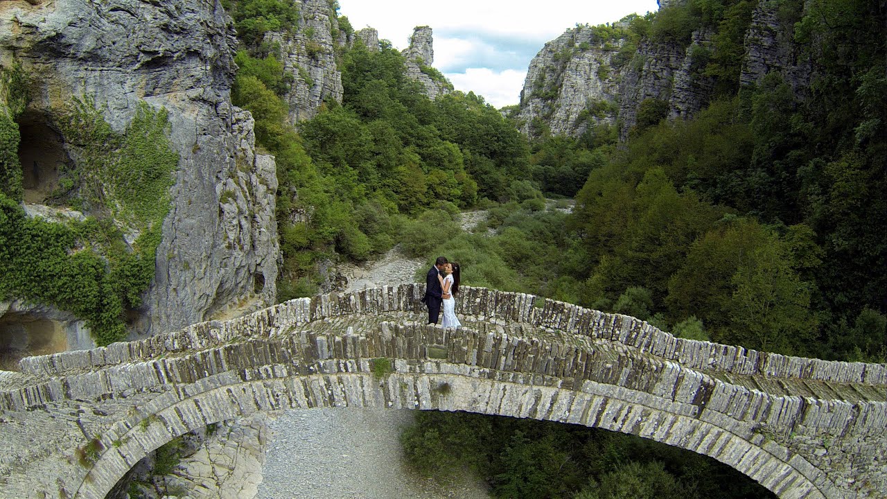
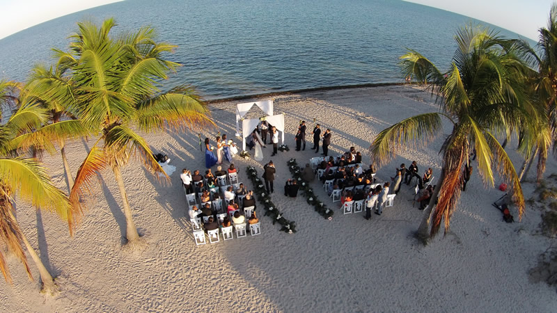
Weddings
Wedding photography has remained pretty much unchanged for years. Couples looking to venture outside the norm can turn traditional wedding memories into amazing overhead perspectives, by hiring a properly certified drone operator for their wedding.
"Some guests told the bride afterward that the drone made them feel as if they were at a celebrity’s wedding" - Inez Edwards.
“Drones are definitely the hot topic in wedding photography and cinematography” Said Justin Fone, who added that 50 percent of his potential customers ask about aerial footage.
Brides are starting to fall in love with drones because they capture the whole atmosphere of a wedding, not just snippets of it. Before you hire a photographer for your big day, contemplate the idea of having your photos and video also taken from a drone overhead. These days drones are quiet, smooth and can carry high end SLR cameras for gorgeous smooth wedding imagery and video.
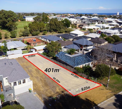
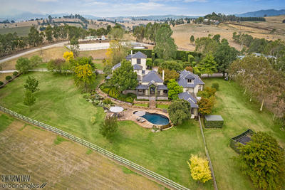
Residential property
Selling your house?
Stunning water views, incredible grounds, envious locations, amazing tennis courts and pools! Show potential buyers what you have to offer - give your residence that extra selling edge with a unique and beautiful aerial perspective.
Building a block of units, or a house with views?
Advertise what the view will look like from each level before it has even been built!
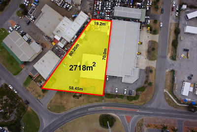
Doing sub division?
Drones can mark out where your property boundary line is with more accuracy than ever.
Commercial property
Selling a commercial property?
Show potential commercial buyers the whole property and surrounding assets or features in one image. An aerial perspective allows the camera to fit more selling points in to the picture! Or, the drone can fly through the inside of your building to optimally showcase the internal features such as modern office layouts or warehouse features and equipment.
Building a commercial office block?
Advertise what the view will look like from each level of a new commercial office block or apartment building before it has even been built. The drone can GPS lock its altitude to pre-set heights/positions and take an image that replicates the view from each prospective floor.
Doing a sub division?
Mark out where your property boundary line is with more accuracy than ever.
Film and TV
Jibs, booms, cranes and dolly’s are a thing of the past! Drones can do this work in a more efficient AND creative way. Drones are powerful enough to carry top class 4K / UHD video cameras such as the Red Epic or Black Magic for buttery smooth ultra-high definition film. They also have the ability to fly at low altitudes which creates opportunities for amazing new angles that full scale helicopters can't get.
Running into the Air - Sebastian Wöber
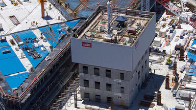
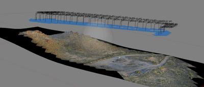
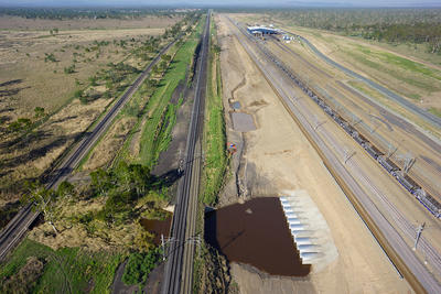
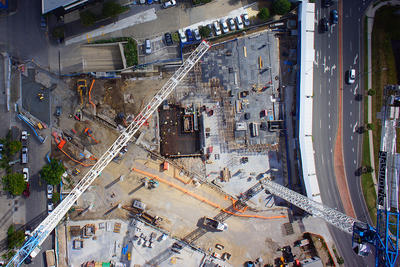
Construction and Engineering
Survey and monitor your project as it develops. Detailed imaging and CAD overlaying allows high quality visual inspections to be undertaken without disrupting your operations. Images can be transmitted to personnel in real time allowing them to focus on inspection efforts without leaving the ground. A comprehensive view can be captured of construction areas, project boundary lines, road or rail works, bridges, ramps and canals.
Drone operators can provide your construction engineer with ongoing aerial images of their site using time lapse photography and oblique photography from pre-development right through to completion.
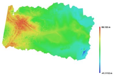
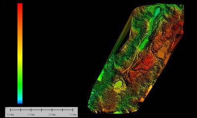
GIS can be used to capture, store, manipulate, analyse and present all types of geographic data.
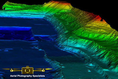
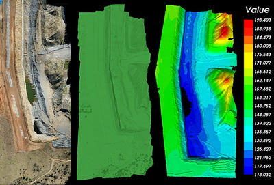
DEM and DSM are valuable tools for internal progress reporting, boundary and topographic surveying and volume calculations.
Events
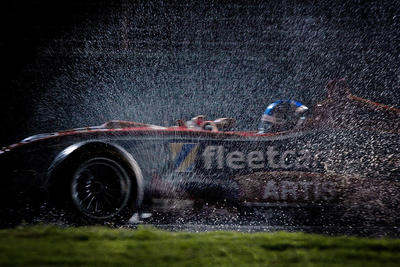
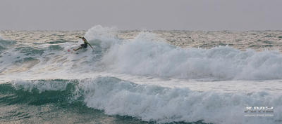
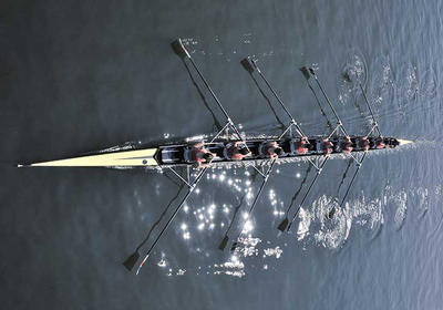
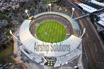
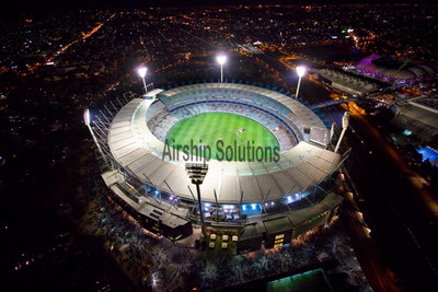
Drones present the latest big leap in sports photography technology. Capture a whole new perspective of your sports event with amazing angles previously not attainable.
Drones also present the perfect way to capture large scale outdoor community events. With the flexibility to fly in all directions, you’re guaranteed to capture every moment of the action.
Capture and record the success of your corporate event, then utilise the images and video later for many other corporate mediums such as your corporate website, brochures, social media posts and TV ads.
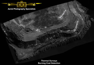
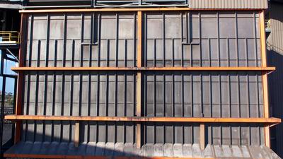
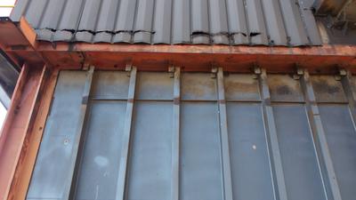
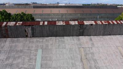
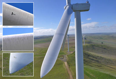
Asset and plant inspection
Drones allow for detailed imaging - high resolution visual and thermal inspections, undertaken without disrupting operations. Images can be transmitted to personnel in real time allowing them to focus on inspection efforts without leaving the ground. Examples:
- Routine Plant Inspections
- Building and Roof Inspections
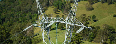
- Power-line Inspections
- Conveyor Inspections
- Pipeline Inspections
- Slope Stability Monitoring
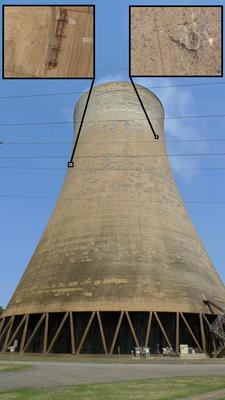
- Tower and Chimney Inspection
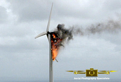
- Wind Turbine Inspections
- Dam Wall Inspections
- Bridge Inspections
- Off-shore rigs
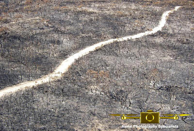
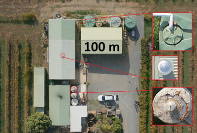
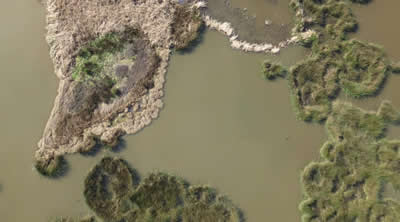
Environmental area
Ecological monitoring and environmental assessments are proactive means for managing the viability and sustainability of a land area. Drones can survey and monitor changes to an environmental area of interest by taking the same footage at different time intervals. Time lapse photography can assist in reporting changes over time due events such as erosion, flooding, weed growth, vermin and unauthorised access.
Drones are airborne based operations which means there is no degradation to the land or vegetation.
Drones can map large areas in 3d. DEM (digital elevation models) and DSM (Digital Surface Models) are valuable tools for internal progress reporting, boundary and topographic surveying and volume calculations.
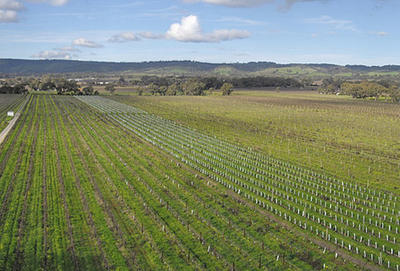
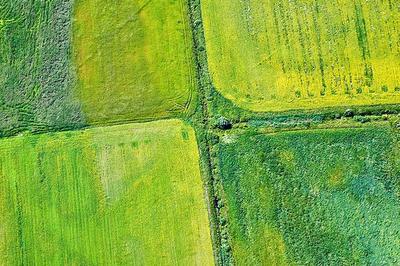
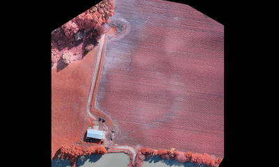
Agriculture
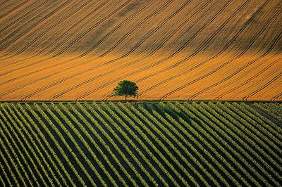
From crop yield management and monitoring to sustainable land use mapping, erosion management, sand dune management and farm planning, drones are an effective and efficient monitoring tool that provide real time visual information of large scale agricultural and environmental areas.
Drones can complete new or routine pre-planned (using GPS waypoints) checks of a geographical area providing a comprehensive overview of troughs, livestock and equipment. Crop growers can use drones to scare off birds at dusk and dawn. Real time information enables clients to efficiently respond to issues observed.
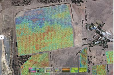
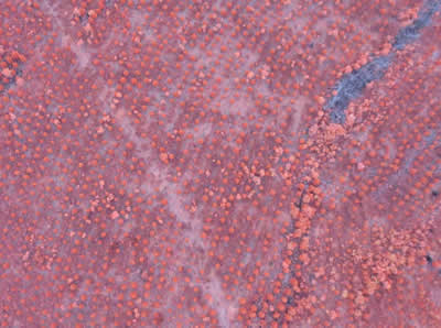
Drones can scan large areas of crops and use NDVI and other technology to determine their health and identify the impacts of pests, soil differences, canopy architecture, irrigation non-uniformities, drought or nutrient deficiencies. Drones may also be utilised to provide early detection of crop stress and as a preventative measure for crop management strategies. Additional capabilities include being able to spot spray crop areas previously conducted by farm vehicles fitted with booms.
With the assistance of supporting software drones can be used to determine the Normalized Difference Vegetation Index (NDVI). They can capture imagery of a crop area and use supporting software to show the state of vegetation surfaces. For example vegetation that is dead or stressed reflects more red light and less near infrared light.
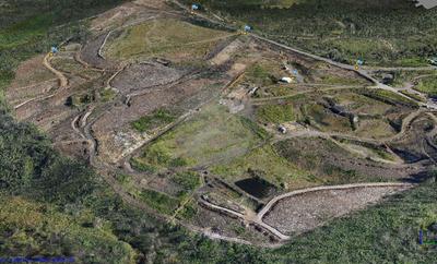
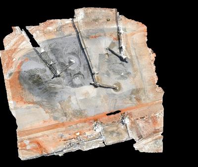
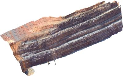
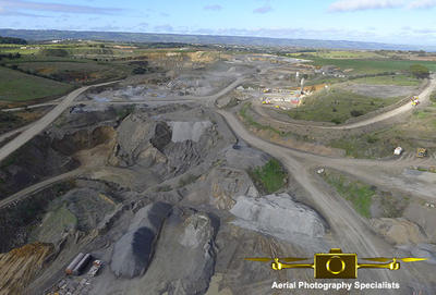
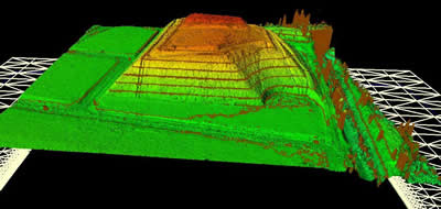
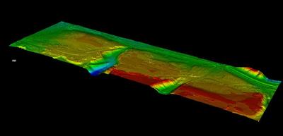
Mines, quarries & landfill
Applications:
- Measure stockpile and blast volumes
- Compare actual against planned site surfaces
- Track site changes over time
- Track wall cracks, erosion, and rock falls from a distance
- Detect pooling on leach pads
- Monitor grades and slopes
- Check batter slopes
- Reduce the amount of site movement
- Less time spent in hazardous zones/areas
- Track the movement of raw materials
- Landfill managers can now measure the amount air in cells
- Reduce your time spent doing visual checking
- Overall better site management – drones are cheaper and safer
Create:
- Digital Ortho-mosaic photos
- Contour maps
- Digital Terrain/elevation/surface Models
- Point Clouds
Emergency services
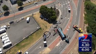
Gather valuable intelligence from an elevated perspective providing real time images to assist your ground teams search and rescue operation. Your team can utilise aerial images and video to help them make more effective tactical decisions on the ground with the best possible information available.
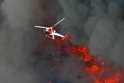
Remove the risk exposure to human beings by using drones in the event of a fire, explosion, chemical spill or similar crisis. A drone can capture live video from inside the hazardous area, and possibly even detect dangerous gasses or smoke and very high temperature areas.


.jpg)