Last updated by Alex W. on 26/09/2025

Drones For Hire recently showcased the cutting-edge DJI Agras T100 spray drone at a field demonstration in Collie, NSW, hosted in partnership with local farmer Terry Wyatt on his canola crop.

The event drew strong interest from local farmers and agronomists, who were eager to see how large-scale spray drones can transform crop protection and input application.

During the demo, the Drones For Hire team highlighted the T100’s versatility and ease of use by showcasing its spraying and spreading abilities over canola, flying both manually and autonomously.

The hands-on demonstration gave attendees a clear picture of how drone technology can improve efficiency, reduce labour costs, and deliver consistent results in Australian farming conditions.

Drones For Hire is proud to support growers like Terry by bringing the latest agricultural drone technology directly into the field, and by offering guidance on training, licensing, and ongoing support.


T100 Spray Drone Demo in Collie, NSW T100 Spray Drone Demo in Collie, NSW T100 Spray Drone Demo in Collie, NSW


Last updated by Nick S. on 05/09/2025

Here’s the straight talk for cane growers getting into drones and weighing up DJI’s T100 vs T70. We’ll keep it practical, Australia-focused, and cane-specific.

The short answer

  • If maximum hectares/day is the priority: T100 has the edge — a touch more capacity (within AU limits), broader effective swath, stronger downwash for canopy penetration, faster connection routing, and more precise height-keeping over uneven cane.

  • If you’re tight on trailer space, budget, or mostly doing lighter work: T70 still gets it done — just expect to run a little slower in cane to keep spray quality up.


Note the T100 is currently selling in Australia (Sep 2025), we suspect the T70P may come here in 6-12 months but don’t have the official news yet. 


Speed (spray vs routing)

  • Top speed: T70P’s max varies by region. Some markets allow 20 m/s; others (e.g., EU) cap it at 13.8 m/s. AU cap is not yet confirmed.

  • Why it matters: High top speed is valuable for return-to-home and connection routing (non-spray legs). If AU gets the higher cap, that’s a T70 plus. If AU is limited to 13.8 m/s, routing will be slower.

  • Realistic spray speeds in cane: To land droplets and push spray into the stalks, plan on ~8–10 m/s. In comparable conditions, the T100’s stronger downwash means you can often run ~1–2 m/s faster than a T70 for the same on-crop quality.

Bottom line on speed: Faster non-spray legs go to whichever platform has the higher regional cap; on-crop spray passes will typically be quicker with the T100 for the same coverage quality.


Legal payload (AU)

  • T100 (AU): 75 L liquid or 75 kg granular (MTOW-limited).

  • T70P: 70 L liquid or 70 kg granular.
    So, within CASA limits, the T100 nets you +5 L/kg per flight. That’s not huge, but over a day it adds up.

Note: Some operators talk about loading beyond 75 L/kg — that’s outside CASA rules. We don’t recommend it.


Spray performance in cane

Brochure effective swath (ideal conditions):

  • T100: 5–13 m

  • T70: 4–11 m

Cane reality check: Dense canopy and tall stalks usually compress brochure numbers. A conservative, real-world expectation might look like:

  • T100: ~5–10 m

  • T70: ~4–8.5 m

Why T100 pulls ahead: Larger airframe and stronger downwash drive droplets deeper into the crop — that’s what lets you hold pattern quality at slightly higher speeds or open swath a little wider without sacrificing deposition.


Granular spreading (when you’re not spraying)

  • T70 tank: 100 L, 70 kg

  • T100 tank: 150 L physical volume, but AU MTOW still caps you at ~75 kg (heavier loads may be allowed elsewhere; follow AU rules).
    If you’re spreading low-density product, the extra 50 L volume on T100 is handy. For typical cane programs where spraying dominates, this is secondary.


Sensing, height-keeping & smoothness

  • T70: Vision/radar based; no LiDAR listed.

  • T100: Adds LiDAR height sensing alongside other sensors.

In variable cane height, LiDAR helps the aircraft track canopy changes more precisely, reducing bobbing and keeping nozzle-to-target distance consistent. Practically, that means smoother passes, fewer sensor-induced slow-downs, and more uniform deposition — especially where stool height and ratoon vigour vary across the block.

(We’ll keep saying it plainly: these are grounded expectations — they align with physics and spec sheets — but on-cane flight hours will always teach you the fine tuning on your farm.)


Productivity per day

Put the pieces together — slightly wider effective swath, a bit more legal payload, stronger downwash allowing ~1–2 m/s higher spray speed for equal quality, faster routing (if caps permit), and fewer sensor-induced stalls — and the T100 should cover meaningfully more hectares per day.

If AU’s T70 speed is capped to 13.8 m/s, the T100’s routing legs pull further ahead.


When the T70 still makes sense

  • You’re space-constrained and want a simpler single-operator rig.

  • You’re budget-sensitive and can trade some throughput for lower capital outlay.

  • Your work is mostly lighter canopy or shorter blocks where the T100’s advantages don’t compound as much.


Setup realities (don’t gloss this over)

  • T100 is bigger. To run it efficiently solo (or to run multiple T100s), plan your vehicle layout, mixing station, battery flow, and staging properly. With a smart truck fit-out, the size penalty disappears and the throughput gains dominate.


Bottom line

  • Chasing throughput in cane? Choose T100.

  • Balancing cost, space, and adequate performance? T70 can still be the right call.
    Either way, keep spray speed realistic for cane (think ~8–10 m/s), set swath by on-crop coverage checks, and stay within AU MTOW limits.


If you’d like block-specific settings (speed, swath, flow, runs, battery rotation) for your cane, we’ll map it out with you and get the numbers dialled. Please ask for Nick or Oscar! 1300 029 829 or [email protected] 


Drones For Hire (DFH) — here when you’re ready to push more hectares, with fewer headaches.


Last updated by Rachel N on 04/09/2025

This step-by-step guide shows ReOC holders how to apply for special approvals when your job needs anything outside the basic Part 101 rules (e.g. controlled aerodrome, >400 ft AGL, BVLOS). It also lists what to prepare before you fill in CASA Form 101-09 and how to keep your application clean and fast.

Here is the link to the CASA Form 101-09.


1) Know what you’re asking for (tick all that apply)

On Form 101-09 you’ll select one or more of:

Area Approvals (CASR 101.030)

  • Above 400 ft AGL in controlled airspace

  • Above 400 ft AGL in non-controlled airspace

  • Within 3 NM of a controlled aerodrome

  • Within 3 NM of a military controlled aerodrome

  • Above 400 ft AGL within 3 NM of a controlled aerodrome

  • Over a movement area of a controlled aerodrome

  • Over an approach/departure path of a runway at a controlled aerodrome

RPA Permissions (CASR 101.080)

  • Over a movement area of a non-controlled aerodrome

  • Above 400 ft AGL within 3 NM of a non-controlled aerodrome

Visual line-of-sight (CASR 101.029)

  • BVLOS (beyond visual line-of-sight)

Tip: If your job is near a towered airport and above 400 ft AGL, you will usually need to tick both the aerodrome proximity item and the above 400 ft item.


2) Pre-application checks & evidence pack

Prepare these before you open 101-09:

Airspace & approvals

  • Use OpenSky (or another approved planning tool) to see whether your site is inside CTR/CTA, near an aerodrome, or within restricted/prohibited areas.

  • Verify with Aviation charts (VTC/VNC/PCA) and the ERSA entry for the nearest aerodrome. Access free resources from Airservices Australia.

Mission planning documents (attach to 101-09):

  • unchecked

    Updated RPAS operations manual

  • unchecked

    Updated RPAS operational procedure (library)

  • unchecked

    Filled Flight Authorisation (from your Ops Manual)

  • unchecked

    Filled JSA (Job Safety Assessment) with a map/screenshot showing site hazards, eg. TOL sites, observers, exclusion & safe zones, signage etc.

  • unchecked

    Filled Risk Assessment (RA) created for this specific mission (not a generic “tick-and-flick”)

  • unchecked

    Site coordinates/ Maps of the operational area (lat/long in aviation format) (KMZ file) 

  • unchecked

    Aeronautical radio qualifications (AROC) is attached


  • unchecked

    Permissions (landowner, council, facility manager) if required

  • unchecked

    Letter of Agreement (LOA) for Defence oversighted aerodromes 

  • unchecked

    BVLOS Concept of Operations document (CONOPS) is attached (if applicable)

If near/inside controlled aerodrome (CTR)

  • VHF radio capability and ATC coordination plan (who/when to call, standing instructions)

  • Be ready to publish/arrange a NOTAM if your approval/ATC requires it (many approvals impose a NOTAM lead time). Keep a NAIPS login handy for briefings and any NOTAM coordination requirements.

If the site is DJI-geofenced

Record-keeping

Ensure your records system:

  • Complies with AIP & Part 101 MOS;

  • Can show evidence of planning on audit;

  • Retains records 7 years and has a backup (or you must cease operations while down).


Last updated by Rachel N on 04/09/2025

Returning to the full service overview? Read the original DFH article:

Get Your ReOC with DFH (Drones For Hire)

1. What is the difference between a ReOC and a RePL? Why do I need a ReOC?

  • RePL (Remote Pilot Licence): A personal licence that allows you to fly drones commercially under someone else’s ReOC, or in limited excluded category operations. 

It is held by an individual and certifies that you’ve completed CASA‑approved training, including aeronautical theory, at least five hours of flight time, and a practical flight assessment.

  • ReOC (Remote Operator’s Certificate): An certificate held by business or organization (including sole traders), it is issued by CASA that allows you (or your company) to operate drones commercially, supervise other RePL holders, and expand operational capabilities via CASA approvals (e.g., EVLOS, BVLOS, night flying, restricted airspace).

👉 Simply put:
RePL = your permission to fly the drone.
ReOC = your right to operate and supervise drone operations professionally.

To dive deeper into what’s required for a RePL in 2025 and how that differs from ReOC, check out this guide: RePL: Licensing for Drone Operations in Australia (2025 Update) (Drones For Hire).


2. Do I need a Remote Pilot Licence (RePL) or Type Rating before applying for a ReOC?

Yes. You must already hold a RePL, and we strongly recommend you to hold the Type rating you want before applying for a ReOC.

  • Any Type Ratings (TRs) (e.g., DJI Agras T50/T100, heavy-lift drones) you want included on your ReOC must already be on your RePL.

  • If you add TRs later, CASA requires a ReOC Variation (Form 101-02) with additional fees and processing. (We can help with that, inquire us for the price)


3. What information and paperwork are required for a ReOC application?

To start your application, you’ll need:

  • ARN (Aviation Reference Number) and ID.

  • Entity details (individual sole trader or company/ASIC extract).

  • Ops scope (what you plan to do) and your aircraft list.

  • Completed CASA Form 101-06, DFH intake form, and supporting documents.


4. What do I need to apply for a ReOC?

In addition to the paperwork, you’ll need to:

  • Decide if you’re applying as an individual or a company.

  • Be willing to go through an interview with a CASA Delegate.

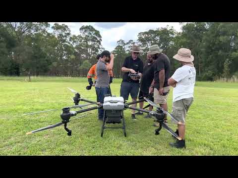
  • Prepare a mission pack (Job Safety Assessment, Risk Assessment, Flight Authorisation).

DFH provides intake forms, templates, and coaching to make this smoother. Steps to prepare a mission pack and the interview will be sent to you after enrolment.


5. How does the ReOC application process work with DFH?

Here’s the workflow:

  1. You choose Fast-Track or Lightweight package.

  2. DFH sends you an intake form + checklist.

  3. You complete CASA Form 101-06 and supply docs.

  4. DFH packages and submits to our Delegate.

  5. Delegate issues custom manual, scenario, and booking link.

  6. You complete the scenario & mission pack, and book a date for an interview with the delegate (online).

  7. Interview with Delegate → Knowledge Deficiency Report (KDR) if needed → fix & resubmit.

  8. Delegate lodges with CASA → CASA issues ReOC.


6. How long does it take to obtain a ReOC?

The exact timeframe depends on CASA’s workload and how quickly you return your documents and amendments, but with DFH’s packaging and Delegate pathway, most applicants receive their ReOC in 2–3 weeks on average. Faster turnarounds are possible if you are ready and responsive.

Typical timeline once all documents are submitted:

  • Time to first contact / pre-interview call
    As soon as we receive your registration, we send you the initial info pack. You’ll need to return two key documents from that email. Once we have everything, allow about 1 week for us to review your application and request amendments if needed.

  • Pre-interview to scenario issue
    The Delegate will send you your assessment scenario 4 days before your interview.

  • Average wait to an interview slot
    Usually 7–10 days to secure an interview with the Delegate once you’re ready.

  • From interview to CASA issue
    After your interview (and closure of any Knowledge Deficiency Report, if issued), the Delegate makes a recommendation to CASA. CASA generally issues the ReOC within 3–5 business days.

👉 Overall: If you’re organised and contact the Delegate quickly, a ReOC can typically be issued in 2–3 weeks.


7. How much does it cost to get a ReOC? What’s the difference between Fast-Track and Lightweight packages?

  • Fast-Track ($2,380): Full support, 2 × 60-min coaching calls, DFH packaging, custom Operations Manual, email support until interview, access to DFH resource kit.

  • Lightweight ($1,980): One 30-min consult, basic packaging, Delegate-provided manual, access to resource kit (ongoing 1:1 help billed separately). 

👉 Choose Fast-Track if you want speed, certainty, and coaching. Choose Lightweight if you’re confident and independent.


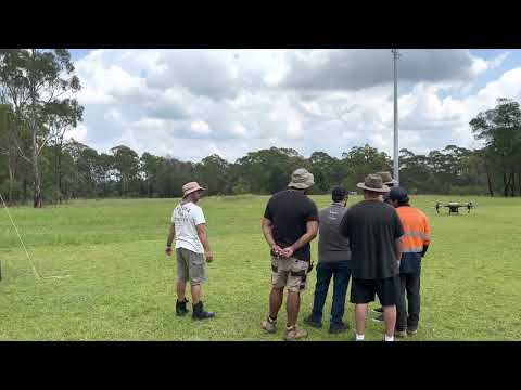
8. What is in the ReOC interview?

The Delegate will test your knowledge of:

  • Your Operations Manual (how your organisation runs safely) → the manual will be provided to you after enrolment.

  • Risk assessments (JSA/RA) and flight authorisation forms.

  • CASA regulatory knowledge (Part 101, airspace, safety rules).

  • Scenario-based planning (showing how you would manage a mission).


9. What is the assessment process?

  • Submit application docs → DFH/Delegate check for completeness.

  • Receive scenario + prepare mission pack.

  • Attend an interview (online or phone).

  • If gaps are found, Delegate issues a Knowledge Deficiency Report (KDR) → you address it.

  • Delegate submits documents to CASA

  • Wait for CASA approval → ReOC issued.


10. Does a ReOC need to be renewed, and what is the process?

  • An initial ReOC is valid for 12 months.

  • Renewals are then valid for up to 3 years.

  • The nominated CEO can renew the ReOC online up to 3 months before expiry, but only if there are no changes to the organisation or its operations.

Important: You cannot renew an expired ReOC. If it lapses, you must apply for a completely new certificate, pay the fees again, and complete the full application assessment.

  • Renewal involves updating your Ops Manual (if needed), ensuring personnel details are current, and resubmitting through CASA.

  • DFH offers consultancy services for renewals, Type Rating additions, area approvals, and other ReOC Variations (Form 101-02).

11. What is a change to a ReOC — CASA Form 101-02 (Variation)

CASA splits changes into significant and insignificant:

Significant Changes

You must submit these through myCASA or using the appropriate form. They typically result in a variation or re‑issue of the ReOC. Examples include:

  • New key personnel (e.g., CRP, CEO, Chief RePL Instructor),

  • Adding Type Ratings (new aircraft types),

  • Expanding operational scope (e.g., BVLOS, night ops),

  • Major revisions to your Operations Manual or safety procedures.

Use CASA Form 101‑02: “Application RPA Operators Certificate (ReOC) – initial issue/variation/renewal”
👉 [Download the form here]


Non-Significant Changes

These are minor edits that do not affect operational safety or scope. Examples include:

  • Correcting spelling or formatting errors,

  • Updating serial numbers,

  • Tweaks to scheduling or safety protocols that enhance safety,

  • Adding a new drone within the already approved scope,

These changes are non-chargeable and typically processed quickly. You can notify CASA via the myCASA portal under “Manage Certificates” → select your ReOC → “Notify CASA of a non-significant change.”
👉 [Download the form here]


👉 Ready to apply? DFH takes care of packaging, manuals, and interview prep so you can get your ReOC faster and with confidence.


Last updated by Rachel N on 04/09/2025

We now offer an end-to-end Remote Operator’s Certificate (ReOC) service for RePL holders.
DFH packages your application, coordinates with our CASA-approved Delegate partner, and gets you interview-ready real fast.

Have more questions about the process or paperwork? Visit our detailed FAQ:
ReOC Frequently Asked Questions


Must-have before you start:

  • unchecked

    RePL already issued, and

  • unchecked

    Any Type Ratings (TRs) you want listed on the ReOC must already be on your RePL.

Note: Adding TRs later requires a CASA ReOC Variation (Form 101-02) and extra fees. If you need help upgrading/adding TRs later, ask for our Consultancy Services (we can guide you).

What you’ll need to start

  • unchecked

    ARN, ID, and entity details (individual or company/ASIC)

  • unchecked

    Your ops scope (what you plan to do) and aircraft list

  • unchecked

    Willingness to complete: Form 101-06, DFH intake form, and provide supporting docs

Note: You do not have to worry about these going with DFH, we will provide a detailed list on what we need from you.


Why DFH?

  • Speed & certainty: We work with an active CASA Delegate. We package clean files so you’re not stuck in back-and-forth.

  • Operator-friendly coaching: Practical help from Rachel (Operations) who supported multiple real-world RPAS jobs.

  • Interview confidence: Focused prep so you know what to expect and how to answer.


Packages

Fast-Track (Recommended) — $2,380

Designed for people who want minimal friction and maximum momentum.

What’s included:

  • 1 × 60-min onboarding call (what to submit, how to fill forms, tidy your docs)

  • 1 × 60-min interview-prep call (Q&A, scenario approach, mission pack check)

  • DFH intake & packaging, handover to Delegate, status tracking

  • Customised Operations Manual, scenario & interview

  • Access to DFH resource kit (NAIPS/ERSA how-tos, mission pack examples and more)

  • Email support up to the interview (short clarifications welcomed)


Lightweight — $1,980

For confident applicants who just want the basics.

What’s included:

  • 1 × 30-min consult (Q&A and direction)

  • DFH intake & packaging → Delegate

  • Delegate provides manual, sends scenario & books interview

  • Access to DFH resource kit

Note: Ongoing 1:1 help beyond the 30-min consult is billed as consultancy.


Our Workflow (at a glance)

  1. Lead in → Tell us if you are Individual / Company.

  2. DFH sends: Intake Google Form + document checklist.

  3. You send: Completed Form 101-06, intake form, and checklist docs.

  4. DFH packages & submits to Delegate (we’re cc’d on key emails).

  5. Delegate:

    • Quick pre-interview call

    • Provide custom manual, sample JSA/RA, scenario, and booking link

  6. You complete scenario answers & mission pack (JSA, RA, Flight Authorisation).

  7. Interview by phone/online → Knowledge Deficiency Report KDR (if any) → fix & return.

  8. Delegate submits to CASA → CASA grants and ReOC issued.


Consulting & how to get the most from it

  • Prepare a written list of questions for our consultant (Rachel) at least 2–3 days before your booking.

  • We’ll tailor the call to your scenario, point you to the right AIP/ERSA/NAIPS references, and show how to evidence your planning.

  • After you speak with the Delegate and receive your scenario, use our resources to assemble your mission pack. We can sanity-check key items in your Fast-Track prep call.

  • Between calls, we’ll handle quick queries by email, deeper work falls under consultancy.


Add-ons & future changes

Need to add a Type Rating later or change your ReOC? 

That’s a Variation (Form 101-02) and attracts extra fees. We have packages to help with TR upgrades, aircraft additions, nominated personnel changes, etc. 

Note: Ask for our Variations & Area Approvals support.


Last updated by Rachel N on 27/08/2025

This step-by-step guide shows ReOC holders how to apply for special approvals when your job needs anything outside the basic Part 101 rules (e.g. controlled aerodrome, >400 ft AGL, BVLOS). It also lists what to prepare before you fill in CASA Form 101-09 and how to keep your application clean and fast.

Here is the link to the CASA Form 101-09.


1) Know what you’re asking for (tick all that apply)

On Form 101-09 you’ll select one or more of:

Area Approvals (CASR 101.030)

  • Above 400 ft AGL in controlled airspace

  • Above 400 ft AGL in non-controlled airspace

  • Within 3 NM of a controlled aerodrome

  • Within 3 NM of a military controlled aerodrome

  • Above 400 ft AGL within 3 NM of a controlled aerodrome

  • Over a movement area of a controlled aerodrome

  • Over an approach/departure path of a runway at a controlled aerodrome

RPA Permissions (CASR 101.080)

  • Over a movement area of a non-controlled aerodrome

  • Above 400 ft AGL within 3 NM of a non-controlled aerodrome

Visual line-of-sight (CASR 101.029)

  • BVLOS (beyond visual line-of-sight)

Tip: If your job is near a towered airport and above 400 ft AGL, you will usually need to tick both the aerodrome proximity item and the above 400 ft item.


2) Pre-application checks & evidence pack

Prepare these before you open 101-09:

Airspace & approvals

  • Use OpenSky (or another approved planning tool) to see whether your site is inside CTR/CTA, near an aerodrome, or within restricted/prohibited areas.

  • Verify with Aviation charts (VTC/VNC/PCA) and the ERSA entry for the nearest aerodrome. Access free resources from Airservices Australia.

Mission planning documents (attach to 101-09):

  • unchecked

    Updated RPAS operations manual

  • unchecked

    Updated RPAS operational procedure (library)

  • unchecked

    Filled Flight Authorisation (from your Ops Manual)

  • unchecked

    Filled JSA (Job Safety Assessment) with a map/screenshot showing site hazards, eg. TOL sites, observers, exclusion & safe zones, signage etc.

  • unchecked

    Filled Risk Assessment (RA) created for this specific mission (not a generic “tick-and-flick”)

  • unchecked

    Site coordinates/ Maps of the operational area (lat/long in aviation format) (KMZ file) 

  • unchecked

    Aeronautical radio qualifications (AROC) is attached


  • unchecked

    Permissions (landowner, council, facility manager) if required

  • unchecked

    Letter of Agreement (LOA) for Defence oversighted aerodromes 

  • unchecked

    BVLOS Concept of Operations document (CONOPS) is attached (if applicable)

If near/inside controlled aerodrome (CTR)

  • VHF radio capability and ATC coordination plan (who/when to call, standing instructions)

  • Be ready to publish/arrange a NOTAM if your approval/ATC requires it (many approvals impose a NOTAM lead time). Keep a NAIPS login handy for briefings and any NOTAM coordination requirements.

If the site is DJI-geofenced

Record-keeping

Ensure your records system:

  • Complies with AIP & Part 101 MOS;

  • Can show evidence of planning on audit;

  • Retains records 7 years and has a backup (or you must cease operations while down).


Last updated by Rachel N on 18/08/2025

Previously, there has been a heated debate on whether the T100 is considered the Medium or Large RPA category. 

Globally, DJI lists Max Takeoff Weight (MTOW) up to 175–177 kg for certain T100 configs → that would be Large RPA (>150 kg). Two weeks ago, DJI limited Australian T100 operations to a maximum gross weight of 149.9 kg. Under CASR 101.022, that places the T100 in the Medium RPA category (>25 kg and ≤150 kg). 

Not just selling the T100, DFH can assist you get compliant fast: RePL, ReOC application support, arrange Type rating exams. We also provide operations setup days.

▶️ Watch on YouTube: https://www.youtube.com/watch?v=mz0rcCpcQ7g


What changed?

  • Weight & category: With operations capped at 149.9 kg MTOW, T100 use in Australia falls under Medium RPA (CASR 101.022)

  • Why that matters: Medium RPA thresholds trigger specific licensing and operational requirements (RePL upgrade - Type Rating, ReOC ops, procedures, documentation).


What you’ll likely need to operate the T100

  1. RePL + Type Rating for the T100 type
    You will need the Standard RePL first. Then a type rating assessment on the T100 is required to legally operate it. DFH is now getting our own TR on T100, we are also happy to assist our customers in arranging the exams.

  2. Operate under a ReOC with appropriate documentations
    For paid/commercial work, you’ll need a ReOC with matching scope, manuals, procedures, and risk controls. Civil Aviation Safety Authority

  3. If you already have the ReOC.

You will need to submit a ReOC significant change to CASA to include the T100 in your operation manual and library. To do it, you need to have obtained the T100 Type rating first. Give us a call if you need assistance.

Please make sure the manual, library, maintenance, RA/JSA, emergency procedures and more, everything is aligned to Medium RPA risk.


How DFH helps

  • T100 sales, commissioning & tech support

  • Authorised sales of DJI Agras T100 with options for finance and insurance referrals.

  • Setup Day (on-site or at DFH): commissioning, firmware, app setup, crew roles, weight & fill calculations (≤149.9 kg), brief on workflow, maintenance & record-keeping, and more!

  • Tech support: phone/email escalation, warranty handling, spares & repairs, firmware/update guidance, and operational troubleshooting.

  • RePL standard course & T100 type training – we can arrange training for you.

  • ReOC application support – we prepare or co-prepare compliant manuals, forms, and evidence packs, then coordinate with a CASA delegate for initial ReOC approval.

Fast-track option: Already flying T50 or other AGRAS drones? We can assist you in how to amend your current systems to Medium RPA requirements, fill the gaps, and schedule your upgrade pathway.


FAQ

  1. Is the T100 “Large RPA”?
    No. In Australia, Large RPA is >150 kg; Medium RPA is >25 kg and ≤150 kg. At 149.9 kg, T100 is Medium RPA.


  1. Can I fly the T100 under the “excluded” category?
    Most commercial work will require a ReOC and RePL (Medium).


  1. I already have a Small RPA RePL—what’s my upgrade path?
    The Part 101 MOS sets standards for upgrading from small to Medium RPA. You will need a Type rating T100 exam to obtain the rating.


  1. I already have a Medium RPA RePL (for T50 type) and a ReOC. What do I need to add to operate the T100?

You’ll need a T100 type endorsement. For the ReOC, ensure your Ops Manual explicitly includes DJI Agras T100 and related procedures Then, submit a ReOC variation (Form 101-02) with updated manual/procedures, and all related documents.
Also, register the T100 with CASA and update insurance (if applicable).


  1. Do I need new manuals?
    Yes, each Medium RPA ops has their own manuals and procedures, maintenance etc. You will need to update your current ReOC and submit it for CASA’s approval.


Get started with DFH

  • Give us a call: On the type of drones you are interested in. We will advise the documents required.

  • RePL upgrade & T100 type training: We’ll arrange your training plan, no worries.

  • ReOC application: Choose DFH-prepared manuals or co-prepared with a CASA delegate


Call 1300 029 829 today to secure your slot for the next T100 intake.


Last updated by Rachel N on 12/08/2025

Modern DJI drones, from the Agras series for spraying to the Mavic 3M and other mapping platforms, already give farmers a big edge in efficiency. But the real power comes when you combine drone imagery with advanced analytics.

Platforms like Solvi and Agremo turn your aerial maps into actionable insights, so you’re not just looking at pretty pictures, you’re making better farming decisions. 

Here’s how each key function works and how it adds value to your drone operations.


1. Stand & Plant Counting – Measure Emergence, Reduce Guesswork

After planting, one of the first questions is: “Did my crop establish well?”
A stand count analysis uses drone imagery to automatically count plants or seedlings across the field.

  • Why it helps: Quickly identifies poor emergence zones so you can decide if replanting is worth it. This means less walking, faster scouting, and targeted action.

  • Drone tie-in: Fly your Agras drone (with camera module) or a mapping drone, upload the images, and get a complete emergence report without stepping into every row.


2. Plant Health & Vigor Maps – Target Inspections and Inputs

Using indices like NDVI, these maps show crop vigor in colour — green for healthy, red/yellow for stressed.

  • Why it helps: Pinpoints problem areas from pests, disease, nutrient deficiency, or water stress before they spread.

  • Drone tie-in: Run a mapping flight with your Mavic 3M or similar multispectral drone, then send the output to analytics software. You’ll know exactly where to spray, irrigate, or test soil — saving time and inputs.


3. Weed Detection & Spraying Zones – Spray Where It’s Needed

AI-powered weed detection identifies weed-infested areas in the field and maps them into zones.

  • Why it helps: Enables spot spraying or variable-rate herbicide application, cutting chemical costs and reducing crop damage.

  • Drone tie-in: Agremo can generate DJI Agras-ready “recipe maps” for immediate spraying. Solvi can also produce weed zone files — you just load them manually into the drone’s app.


4. Yield Prediction – Plan Harvest and Marketing

Yield prediction tools estimate production before harvest, using plant counts, health data, and growth models.

  • Why it helps: Allows you to plan storage, logistics, and sales earlier in the season, and manage cash flow with more certainty.

  • Drone tie-in: Capture imagery mid-season, run the analysis, and adjust fertiliser or irrigation to boost yield where it matters most.


5. Specialty Analyses – Go Beyond Basic Mapping

From trial plot analysis for research to damage assessment for insurance claims, specialised analytics open up new value streams.

  • Why it helps: Gives you data-backed evidence for insurers, trial partners, or agronomy decisions. Productivity zoning helps you manage variable inputs more efficiently.

  • Drone tie-in: Use your mapping drone to capture high-resolution images after storms, trials, or throughout the season — then turn those images into actionable maps and reports.


6. DJI Agras Integration – Close the Loop from Map to Action

Analytics aren’t just about observation — they guide immediate action.

  • Why it helps: By linking analytics outputs to your Agras spray missions, you can act on insights instantly — whether it’s spraying only stressed areas, adjusting rates for different zones, or applying fertiliser where it’s needed most.

  • Drone tie-in: Agremo offers one-click DJI Agras compatibility, while Solvi exports standard SHP/GeoTIFF files that you can import into the DJI app.


The Bottom Line

Your DJI Agras or mapping drone is a powerful tool, but pairing it with analytics like stand counts, vigor maps, weed detection, yield forecasts, and zone management transforms it into a complete precision agriculture system.
Instead of treating every hectare the same, you can make data-driven, targeted decisions that save time, reduce costs, and maximise yields.

Whether you use Solvi’s fast, flexible self-service tools or Agremo’s turnkey, Agras-ready reports, integrating analytics into your drone workflow means you’re getting the absolute most out of your investment.


Check out this article to decide between Solvi and Agremo!


Last updated by Rachel N on 12/08/2025

In the last article, we discussed Drone Analytics in the Agriculture field. Check it out!


This article provides a technical yet farmer-friendly comparison of Solvi and Agremo, helping you understand which tool might fit your needs and encouraging you to try these modern solutions for crop analysis and yield predictions.


Introduction
Drone analytics can turn aerial imagery into actionable farm insights. Solvi and Agremo are two leading platforms, both work with DJI drones but serve slightly different needs.

They can produce field maps (like NDVI plant health maps, weed hotspot maps, plant counts, and more) to help improve yields and efficiency. However, they differ in their approach and strengths. 


Key Differences at a Glance

Feature

Solvi (DIY Analytics)

Agremo (Report-Based Service)

Main Focus

Research trials, crop counting

Broad-acre precision farming, yield prediction, spray maps

Speed

Same-day results (30–60 min processing)

1–2 days for polished reports

Best For

Agronomists, researchers, tech-savvy farmers

Large-scale growers, DJI spray drone operators


Solvi – Fast, Flexible, Research-Friendly

Workflow: Upload images → process → interact with results.

Solvi offers a Real-time analytics tool. It involves plant counts (via PlantAI™), custom AI training for unique crops, and plot-level trial analysis.

Users upload drone images to Solvi’s cloud, which then quickly stitches the photos into an orthomosaic map and runs analyses. Processing is fast – imagery is typically converted into accurate maps within 30–60 minutes of upload solvi.ag . Solvi emphasizes giving agronomists direct control: with its PlantAI feature, you can perform your own plant counts or detect weeds in the same day (often an hour or two after flying, depending on field size). The platform originated in research and field trial applications, so it offers fine-grained analysis (e.g. per-plot metrics for trials) and even allows training custom AI models for unique crops solvi.ag . 

In short, Solvi’s workflow is interactive and on-demand – you collect imagery and get results back immediately, which is valuable for timely scouting and decision-making.


Agremo – Farmer-Focused

Workflow: Upload images → request analysis → receive ready-to-use reports.

Agremo is more like an all-in-one farming service. It can handle everything from image stitching to analysis to reporting. Agremo offers multiple product modules, for instance, 

  1. Crop Monitoring (for farmers and crop advisors), and 

  2. Field Trials (for researchers)

Agremo’s focus is broad-scale farm management – it covers standard use-cases like stand counts, yield estimates, weed zone maps, plant stress detection, and even direct “prescription” maps for variable-rate applications.

They all operate through a unified web app. A key difference is that many of Agremo’s advanced analytics are delivered as reports on a request basis. After uploading your mapped images and selecting an analysis, you often wait up to 1–2 days to receive the results. This slower turnaround reflects that Agremo’s team or algorithms are processing the data with quality checks, and then providing a polished PDF report, shapefiles, and other outputs. The advantage is that the results are thorough and ready to use, with minimal effort from the user. 


In summary, Agremo’s workflow feels more “send and receive”, you request an analysis and get a professional report a bit later, making it convenient for busy growers who want actionable insights without tinkering with software.


Which Should You Choose?

  • Choose Agremo if you operate DJI Agras drones, need compliance-ready spray maps, and prefer quick, ready-to-use reports.

  • Choose Solvi if you run research trials, work with specialty crops, or need same-day, customizable analytics.


Note: DFH is exploring offering Agremo as a reseller to make it more accessible locally, more information and pricing will be available closer to the date. Keep an eye out for our updates.


Last updated by Rachel N on 01/08/2025

Many customers who recently purchased the DJI Matrice 400 (M400) have reported an issue where the drone cannot link to payloads like the Zenmuse L2 or P1.


We also have the youtube video guiding you through the process ^^ Step-by-step video guide


Why Does This Happen?

This issue occurs because the payload firmware is outdated and does not recognize the newly released M400. While the M400 comes with the latest firmware, older payload versions were designed for the Matrice 300 RTK.


Currently, this cannot be fixed by connecting the payload to DJI Assistant 2 via USB, as the update will fail when the payload is not recognized. Instead, you need to perform an offline firmware upgrade using an SD card.


Steps to Pair M400 with Payloads (L2, P1, etc.)

  1. Download the Latest Firmware

    • Search for the latest firmware update for your payload (e.g., Zenmuse L2 or P1) on the DJI official website.

  • Download the .BIN file (example: Zenmuse L2 Firmware v05.00.10.01).


  1. Prepare the SD Card

    • Insert an SD card into your computer using an SD card reader.

    • Pull the downloaded .BIN file into the root directory of the SD card.

  2. Insert the SD Card into the Payload

    • Remove the SD card from your computer and insert it into the payload.

  3. Power On and Connect

    • Turn on the M400 and the remote controller.

    • Ensure the payload is properly mounted and connected to the aircraft.

  4. Firmware Update Process

    • The payload will start updating automatically.

    • Indicators:

      • White lights will blink.

      • You’ll hear four long beeps during the update process.

    • Wait approximately 5–10 minutes for the process to complete.

  5. Update Complete

    • When the update finishes, you’ll hear two short beeps followed by two long beeps.

    • Power off the aircraft.

  6. Clear the SD Card

    • Remove the SD card and insert it back into your computer.

    • Delete the firmware update package from the SD card to avoid re-installation.

  7. Reinsert the SD Card

    • Place the SD card back into the payload.

    • Power on the aircraft and remote controller.

    • Your payload should now link successfully and be ready for activation and use.


Pro Tip

Always ensure your M400 and payloads are running the latest firmware versions to maintain compatibility and performance.


Need Help?

If you encounter any issues during the update process, Drones For Hire can assist with payload firmware upgrades, DJI enterprise support, and M400 integration.


Contact us:

1300 029 829 | [email protected]