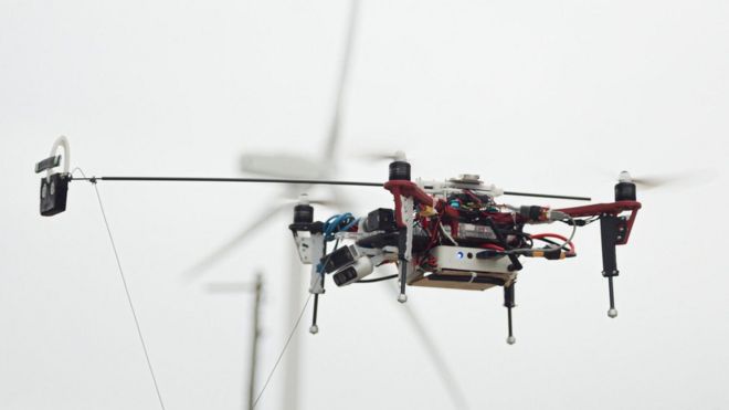
LiDAR is one of the most important tools in the commercial drone industry. While it has been around since the 1960s when it was mounted to aircraft, its uses have expanded dramatically now that LiDAR can be used with commercial drones.
What is LiDAR and how does it work? LiDAR is a remote sensing technology: sensors that are mounted to drones send a pulse from a laser to collect measurements, which can then be used to create very precise models (including 3D models) and maps of objects and environments.
LiDAR is an acronym for Light Detection and Ranging. The idea behind the technology is conceptually simple: LIDAR measures distance by measuring the time that it takes to get the laser pulse to the measured object and back. By doing this many many times per second, you can get an accurate distance and gain enough information to be able to tell quite a bit about the object that you are looking at.
We recently found an interesting piece in Grind GIS here that should help to broaden your understanding of the potential uses of LiDAR technology. You will see that it is used in surveying and mapping, agriculture, forestry, police and firefighting, forestry, environmental assessment and more.
1. DEM (Elevation Value): DEM stands for digital elevation model which has z coordinates value along with x and y. Elevation values are used everywhere, inroads, building, bridge and other. It has made easy to capture the surface height. Before LIDAR, ground survey or photogrammetry method was used to capture the z coordinates but the problem with this method was time-consuming. LIDAR has made things easier and quicker.
2. Micro-Topography: LIDAR is very accurate and precise technology which uses a laser pulse to strike the object. Regular photogrammetry or other survey technology can miss the surface elevation value that is hidden by vegetation or forest canopy. But LIDAR can penetrate through the object and detect the surface value.
3. Agriculture: LIDAR helps the farmer to find an area that uses costly fertilizer. LIDAR can be used to create an elevation map of the farmland that can be converted to create slope and sunlight exposure area map. Both the layer information can be used to create high, medium and low crop production area. The extracted information will help the farmer to save on the costly fertilizer.
4. Forest Planning and Management: LIDAR is widely used in the forest industry to plan and manage. It is used to measure the vertical structure of the forest canopy and also used to measure and understand canopy bulk density and canopy base height. Other uses of the LIDAR in the forest industry is the measurement of the peak height to estimate its root expansion.
5. Forest Fire Management: LIDAR is becoming widely popular in forest fire management. The fire department is transforming from reactive to proactive fire management. LIDAR image helps to monitor the possible fire area which is called fuel mapping (fire behaviour model).
6. Precision Forestry: Precision Forestry is defined as planning and operating the site-specific forest area to increase the productivity of wood quality, reduce cost and increase profits, and maintain the environment quality. LIDAR and aerial photo is used to perform precision forestry.
7. Tourism and Parks Management: LIDAR DEM is used to plan the park and tourism area. High accurate surface models help to find the best area to have a playground, trees, and walking trail. Parks management is a big business and LIDAR technology is playing a vital role in its management. 3D image of the park, generated from LIDAR technology helps for the future growth of the park.
8. Environmental Assessment: Micro topography data generated form the LIDAR data is used in the environmental assessment. Environment assessment is done to protect the plants and environment. Remote sensing and surface information (LIDAR) is used to find the area that is affected by human activities.
9. Biodiversity for Birds: As LIDAR technology is evolved in finding detail information about the forest. Forests are homes for different types of birds, animals and insects. Science uses LIDAR data to analyze forest (vertical structure) to see whether it is a suitable place for them. Vertical structures of trees, shrubs, and other plant tell what species can live and prosper in that area.
10. Flood Model: LIDAR provides very accurate information. Rivers are very sensitive and few meters of change in information can bring disastrous or loss of properties. So LIDAR is used to create high resolution and accurate surface model of the river. This extracted LIDAR information can be used for the 3D simulation for better planning of the structures or buildings on the river bank.
11. Watershed and Stream Delineation: DEM generated from LIDAR is used to create watershed area and streamline delineation. High and accurate DEM is the major input to create this and GIS software is used to create it. This way you can calculate watershed for the particular water channels and find an out-stream channel for overland flooding.
12. ELC: ELC is the short form of Ecological & Land Classification. It is done to provide the biological and physical information of the Landscape which helps in sustainable management. ELC process helps in the range of sectors like land-use planning, environmental assessment, forest management, habitat management and many more. During the classification of Land, high-resolution LIDAR data helps to understand the nature and type of the land, that will help in the ELC process.
13. River Survey: Water penetration green light (532 nanometers) of the LIDAR is used to measure underwater. Underwater information is required to understand the depth, flow strength, and width of the river and more. For the river engineering, its cross-section data is extracted from LIDAR data (DEM) to create a river model, which will create a floodway and flood fringe map. LIDAR data can be used by the marine engineer to understand marine life,
14. Modelling of the Pollution: a LIDAR wavelength is shorter which operates in ultraviolet, visible region or near-infrared. This helps to image the object which is in the same size or larger than the wavelength. So LIDAR can detect pollutant particles of carbon dioxide, Sulphur dioxide and methane. This information helps researched to create pollutant density map of the area which can be used for better planning of the city.
15. Mapping: Surface model created from LIDAR is used to add graphical value to maps. DEM (from LIDAR) is added underneath of all layers that shows the 3D view of the land. Especially LIDAR data (DEM) is added on the aerial photography to show the 3D view which makes easier to plan roads, buildings, bridges and rivers.
16. Management of Coastline: LIDAR data of the coastline surface and under the water surface can be combined by researches to analyze the behaviour and area of the waves covered by them. If these data are captured periodically then the marine scientist can understand the coastline erosion occurrence.
17. Transport Planning: LIDAR data for road helps the engineer to understand it and give a roadmap for the building it. As LIDAR are highly accurate technology it helps to understand the width, elevation and length of the existing road. Besides, civil engineers use LIDAR data to cut & fill, do culvert sizing, vegetation removal, grade calculations and more.
18. Oil and Gas Exploration: As LIDAR wavelengths are shorter, it can be used to detect molecules contained in the atmosphere that has the same or bigger wavelength. There is the new technology called DIAL (Differential Absorption LIDAR) which is used to trace amount of gases above the hydrocarbon region. This tracking helps to find the Oil and Gas deposits.
19. Mining: LIDAR is also used in the mining business in various tasks. It is used to measure the ore volume by taking a series of photos of ore extraction space. These interval photos are used to calculate the volume.
20. Archaeology: LIDAR has played an important part for the archaeologist to understand the surface. LIDAR can detect micro-topography that is hidden by vegetation which helps archaeologist to understand the surface. DEM created from LIDAR is feed into the GIS system and it is combined with other layers for analysis and interpretation.
21. Exploring Quarries and Minerals Area: For Archaeology it is important to understand human civilization by finding the quarry and minerals site. So LIDAR is used to detect these spot.
22. Viewshed Analysis: Viewshed analysis is a common name in GIS, it uses a digital elevation model (DEM) to create a viewshed map. It uses individual cell to determine that is visible or not from all other remaining cells. Accuracy of analysis depends on the inputted DEM. So high accurate DEM generated from LIDAR is used for these type of analysis.
23. Solar Energy Planning: Solar energy is getting popular for heating and electricity purpose. Solar panels are used to absorb the heat energy from the sun and it is converted to heat or electricity energy. For the installation of the Solar panel, there are some basic requirements which are identified by the help of the LIDAR data. Like Solar panel should be kept to the south-facing of the roof and it should have minimum area and so on.
24. Right to Light: Every house owner has right for the light, other types of construction should not block the light for the individual. As LIDAR data can capture the 3D model of the building, GIS analysis can be used to produce a shadow map which shows illumination area during a particular time of the day.
25. Glacier Volume Changes: LIDAR is used to calculate the glacier change over the period. LIDAR image is taken in time series to see the change happening. For example, LIDAR image was taken of Iceland from 2007-2009 and project was completed in 2012. These captured data will help scientist to know the amount of volume change.
26. Gaming: LIDAR technology is used to capture the surrounding area and this data is feed into the computer and colour code is added to it. For example for the race track game, LIDAR will be used to capture the view of the real race track. This captured race track data will be used for the game.
27. Accident Scene: Ground-based LIDAR can be used to capture the accident and crime scene. LIDAR technology can be used quickly to record the accident scene on the road that can be used later for the investigation. This allows the traffic to flow smoothly if there is the accident.
28. Architecture: Ground-based LIDAR technology can be used to capture the structure of the building. This digital information can be transfer to a computer for architecture to design the house model.
29. Recording of Building: Ground-based LIDAR can be used to record the inside of the house. It can be used to record the interior design too. This extracted data can be printed on the 3D printer to model it. Or when the building is rebuilt, this recorded information can be used to restore the interior design.
30. BIM: GIS is a valuable tool that helps in the planning, organizing and subsequent growth in the energy and utility industries. The effective management of energy systems is a complex challenge. GIS has enormous potential for planning, design and maintenance of the facility. Also, it provides improved services cost-effectively.
31. Cellular Network Planning: LIDAR can survey the area with less time compared to other methods. The collected surface model can be feed into the GIS system to create a line of sight or viewshed map. This outputted map can help a cellular engineer to find the proposed cellular antenna.
32. Vehicle Automation: LIDAR is becoming more popular in vehicles to make it automatic. LIDAR is used to grab the information on the road and it is passed to the computerized system to make a humanlike decision. For example, LIDAR can detect the road yellow lines which tell the vehicle to stay within yellow lines. Nowadays vehicle uses Adaptive Cruise Control (ACC) which has LIDAR technology. It helps the vehicle in cruise control slow down when there is a vehicle in the front and also speed up when there is no traffic.
33. Sewer and Manhole Survey: There is someplace in the sewer line where that is not physically accessible. In this situation sensor attached with the robotic machine are sent into the pipe for a survey. This information is later fed into a computer for analysis.
34. Meteorology: LIDAR has been used for the study of clouds and their behaviour since it was invented. It uses its wavelength to strike small particles in the cloud to understand it. There are different kinds of LIDAR which are used for various purposes in meteorology.
Elastic backscatter LiDAR: It is the simplest type of LiDAR and is typically used for studies of aerosols and clouds.
Differential Absorption LiDAR (DIAL): It is used for the measurements of gas like ozone, carbon dioxide, or water vapour.
Raman LiDAR: It is also used for measuring the concentration of atmospheric gases but also to take the number of aerosol parameters present.
Doppler LiDAR: It is used to measure wind speed.
35. Geology: In geology, the combination of LIDAR aircraft and GPS has evolved so much it is used finding the fault and measuring the uplift. The combination of the above technology was used to find the Seattle fault in the Washington State, USA. NASA satellite called ICESat that has LIDAR sensor is used to monitor glaciers and perform coastal change analysis.
36. Astronomy: In the exploration of MARS, LIDAR technology was used to create the topographic map of the red planet (the NASA Mars Global Surveyor). NASA\’s Phoenix Lander used LIDAR technology to detect snow falling in the Mars atmosphere.
37. Atmospheric Physics: In the Atmospheric Physics, LIDAR is used to measure the concentration of oxygen, nitrogen, potassium, sodium and other gas particles in the middle and upper atmosphere. This information is used to create a density map.
38. Oceanography: LiDAR is used for calculation of phytoplankton fluorescence and biomass in the ocean surface. It is also used to measure the depth of the ocean (bathymetry). A typical example will be measuring of the coral reef.
39. Military: LIDAR has always been used by the military people to understand land. It creates a high-resolution map for the military purpose.
40. COPS: It is quite common technology in the law enforcement department. Police use LIDAR gun to detect the speed of the vehicle and also to understand the traffic flow. This technology is so precise that they can pick up the targeted vehicle from the cluttered traffic.
41. Forensic: 3D Laser scanning or LIDAR is becoming quite popular in forensic examination. Though the technology is new, it is embraced by the police department, law enforcement agencies and government crime agencies.
42. Imaging: LIDAR technology is used to create a 3D image of the object that is in distance. 3D imaging is done with both scanning and non-scanning systems. There is a technology which uses a combination of fast gated camera and LIDAR to created 3D image (3D gated viewing laser radar). It is a non-scanning system.
43. Wind Farm: LIDAR is used in the wind farm to calculate the direction and strength of the wind. LIDAR attached to the turbine helps to change the direction of the blade to generate more power.
44. Dune Monitoring: LIDAR is used to monitor the dune activities. It includes a change in size and shape, vegetation, rate of change and other related dune activities.
45. Urban Municipality: LIDAR is used by the urban municipality to survey the city. As LIDAR is accurate and quick to survey, it helps the municipality to know where things are and what are the changes happened in the city. City assessment department can use LIDAR to find out what are things build up in the public backyard.
46. Railway Infrastructure: Traditionally railway track measurement was done by regular survey system. Now LIDAR can quickly perform the measurements of the railway track and the topographical and surrounding area of the railway path.
47. Airport Infrastructure: LIDAR is used to capture features in the airport like runways, terminal buildings, hangars and other objects. This allows the airport authority to manage and operate the airport system smoothly.
48. Tunnel Surveying: LIDAR is used to measure accurate and detailed measurements, used for analysis, assessment and modelling of the tunnel that is for railway track or road. This might be in the mountain, land or underwater.
49. Tsunami Inundation Modeling: Tsunami is a well-known natural disaster and can take thousands of lives and may damage infrastructure. LIDAR technology help scientist to understand the area that will be covered when the tsunami happens. DEM produce by LIDAR gives the elevation value of the seashore and bathymetric data provides underwater elevation. This information, layered in the GIS will provide the inundate area when Tsunami occurs.
50. ISMP: Integrated Storm Water Management Plan has become a popular name compare to the traditional system, which is an ecosystem-based approach to rainwater management. The goal of ISMP is to balance between land use planning, stormwater engineering, flood and erosion protection, and environmental protection. For the ISMP or traditional stormwater management system, elevation map is important. It is easy to produce contour from DEM which is created from the LIDAR data. LIDAR data are accurate and precise.