Deep underground, where ‘hi-vis’ figures and gargantuan machines toil in an ageless quest for humankind’s most precious metal, gold, there’s a new worker: a whirring, spider-like creature filming, mapping and analysing, unfazed by the constricted atmosphere and its many dangers.
This new machine – tiny against the giant crushers, haulers and crawlers – can fly and hover and even rise to work in normally unreachable cavernous stopes, all by itself. Its stereoscopic cameras are not just its tools, but also its eyes. It navigates, like us, by seeing.
The machine is a mining drone, as much at home in this subterranean space as it would be flying above the Earth. It represents a new age for geology and underground mining, and also a juncture in multidisciplinary research.
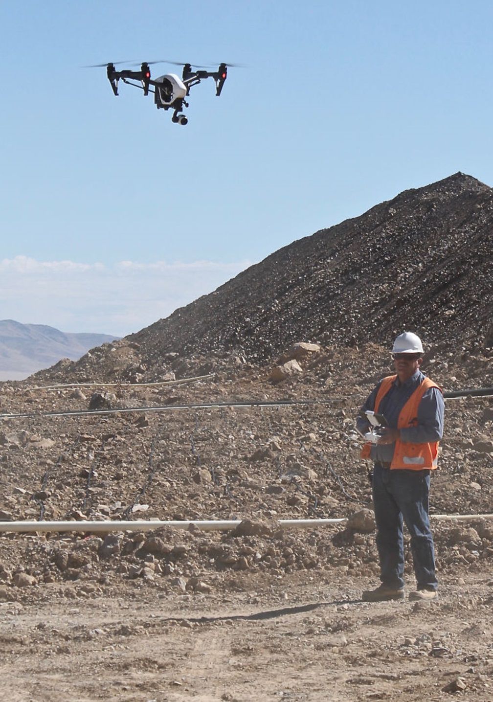
The scientist behind this drone, and others being tested in working gold mines in Victoria and Tasmania, Australia, is Associate Professor Steven Micklethwaite, a geologist with Monash University’s School of Earth, Atmosphere and Environment. The drone, and the technology carried in its underbelly, is the work of a collaboration with other Monash specialists in robotic vision systems, artificial intelligence, information technologies (IT) and, of course, drone-building.
The core innovation the team is developing is the drone’s capacity to fly autonomously along a shaft or through a tunnel, and create, in real time, 3D models of its surrounds and geological maps.
“It guides itself with lasers and the same high-definition stereo video cameras it is using to create the 3D models,” Associate Professor Micklethwaite explains.
“But that’s just the hardware development. The other side is turning the imagery into useable information – for example, computing an instantaneous map that a geologist would otherwise spend days or months building up.”
The industry application covers the full suite of mining operations, from geology and resource assessment, through to monitoring the integrity and safety of an underground infrastructure.
Associate Professor Micklethwaite describes how the drone could arrive at the site of the most recent blast, photograph and map the exposed geology, and transmit or fly the data back to the surface for geologists to assess the resource from a 3D map just created: “From the orientation of the geological features exposed, a geologist can predict the nature of the deposit in the next section of rock,” he says.
In time, Associate Professor Micklethwaite says, the drones may alleviate the need for humans to even enter underground mines. Given the high costs and safety risks in putting people underground, any technology that negates this will boost mine economics and save lives.
He anticipates similar efficiency gains for geology through the introduction of artificial intelligence. “I might have several square kilometres of landscape on which I have to map all the faults and fractures or identify the different stratigraphic layers and measure their orientation. For me to do that at a five-millimetre resolution would take years. But now we can map with the drone, teach a computer what to look for and then propagate that learning through the rest of the data. All I have to do as a geologist is check the computer got it right, which gives me far more time to properly understand what the map is telling us.”
For Associate Professor Micklethwaite the technology and his research collaborations are reinventing the ancient science of geology: “My motivation for getting into geology was to understand earth processes; to see how rivers were changing, how valleys had eroded, to see rocks and understand the stories they had to tell about Earth evolution. But it all takes so long with standard techniques.
“So when cheap and available drone technology arrived I engaged with it very quickly, and from there a whole new
world of possibilities has opened up for earth sciences.”
Associate Professor Micklethwaite says the future for the technology is expansive. “It’s going to be applicable in so many areas … even forestry and bushfire management, for example. If we can build drones that can detect leaf structure and fine branch structure, we could be flying beneath trees measuring, for example, biomass build-up in areas otherwise too difficult to reach.